DH Research
Real and imaginary colonial geography

How do imperial imagination—culture, symbols, art, language, tropes—and imperial reality—conquest, territory, enslavement, exploitation—shape each other? In particular, how do the geographies imagined in colonial texts relate to concrete colonial maneuvers?
To approach these general questions, I conducted a computational analysis on the relationship between the geographies of eighteenth-century British maritime literature and ship itineraries. Specifically, I trained a custom named entity recognition (NER) model to find and count place names in a mid-size corpus of texts, then compared those results to archives of voyages by Royal Navy, British East India Company, and slave trading vessels. I cast colonial place names as navigational technologies akin to the logbook, the ledger, and the geographic information system (GIS), offering that by turning the methods of imperial geography back on itself, we can better dissect their continuing functioning in order to counter them. Specifically, in addition to findings on English nationalism, fungibility in Africa and China, and the imaginary bypassing of environmental constraints, I find that imaginary geographies anticipate real colonial conquest. I affirm Edward Said’s argument: “The slow and often bitterly disputed recovery of geographical territory which is at the heart of decolonization is preceded—as empire had been—by the charting of cultural territory.”
The first phase of this project appeared in PMLA. I also designed an interactive Shiny app to map the places mentioned in texts alongside ship itineraries. The project also informed a forthcoming chapter, “Mapping Empire’s Horror: Literary GIS and Colonial Spatial Logic” in Space and Literary Studies, edited by Elizabeth Evans for Cambridge University Press. There, I argue that “literary GIS,” the subfield of the digital humanities that uses geographic information systems (GIS) to make digital maps of texts, is useful insofar as it can help us see colonial spatial logic–largely because it depends on such logic–but that such vision does not necessarily help articulate alternatives to empire. Future work on this project will revise the methods for detecting place names, consider non-toponymic geographies, and compare the findings to later anti-colonial and colonial writing from the United States.
The second phase of this project is in its early stages, and it will look at alternative methods for finding place names in eighteenth-century texts.
Modeling domestic space
Collaborators: Mark Algee-Hewitt; Svenja Guhr; Jessica Monaco; Matt Warner
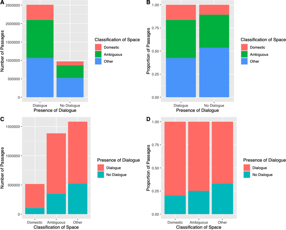
My collaborators and I modeled the occurrence of domestic settings in thousands of nineteenth-century British and Irish novels. One impetus for the project is attempting to stretch computational literary geography beyond a focus on place names. We find that domestic spaces are connoted through gendered and classed modes of individual address, rather than denoted by proper and common noun spatial terms.
We published a description of our model in JCLS. We are submitting a second article describing our findings about how domestic space is signified.
Scientific passive voice and objectivity
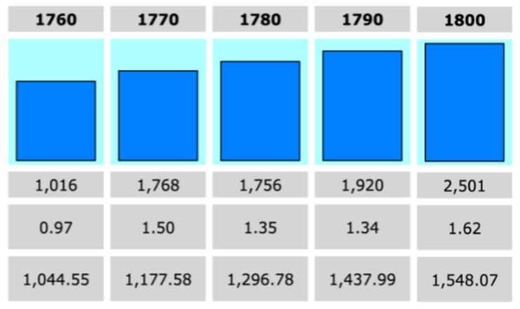
Working with collaborators at Saarland University, I am analyzing 48,000 scientific articles from the Royal Society Corpus that studies their usage of the passive voice along with other epistemic markers associated with objectivity. Building on similar questions motivating my first book’s close readings of the virtual position–one plank of which is the passive voice–this project asks where, when, how, and why the passive voice specifically became so prevalent in science writing. Early findings suggest that the late eighteenth century was a decisive period. Possible hypotheses include that the passive voice correlated with topics related to navigation at sea; the precursors of what would become colonial anthropology; and the institutionalization of science under state agencies.